Saturday, June 20, 2015

Hiking Talk #18: Mt. Daraitan - Tinipak River Limestones

MINOR CLIMB| Mount Daraitan sits near the border of Tanay, Rizal and General Nakar, Quezon and is at the heart of the famous Sierra Madre mountain range. There are two peaks that connect the beauty of Daraitan. The peak one which is the most visited, stands at 739 MASL and is marked with a mounted flag pole up on the summit. The peak two on one hand is the smaller mountain that stands below the river of the well known, Tinipak.

The Mt. Daraitan "peak one" was first made open to public as an ecotourism site late year 2012 and today, the mountain is among the top visited and day-hikable mountains near Metro Manila. A model of ecotourism that offers outdoor attractions and viewpoints such as limestone formations, springs, natural fresh pools and caves. The barangay officials organised a systematic handling of tourist, an indicator of a spot suitable for ecotourism, including hiring of trained, courteous local guides.

HIKING
Hiking in the honor of our country's 117th Independence. The trek starts at the Brgy. Hall of Daraitan. First up, arrange/secure a local guide, attend a 5-min-orientation and mind setting activity. A tough start of hiking the trail is mostly straightforward, an ascent of 600+ meters.

Few minutes after heading from the start, a steep trail challenges those who are not used to regular hiking.
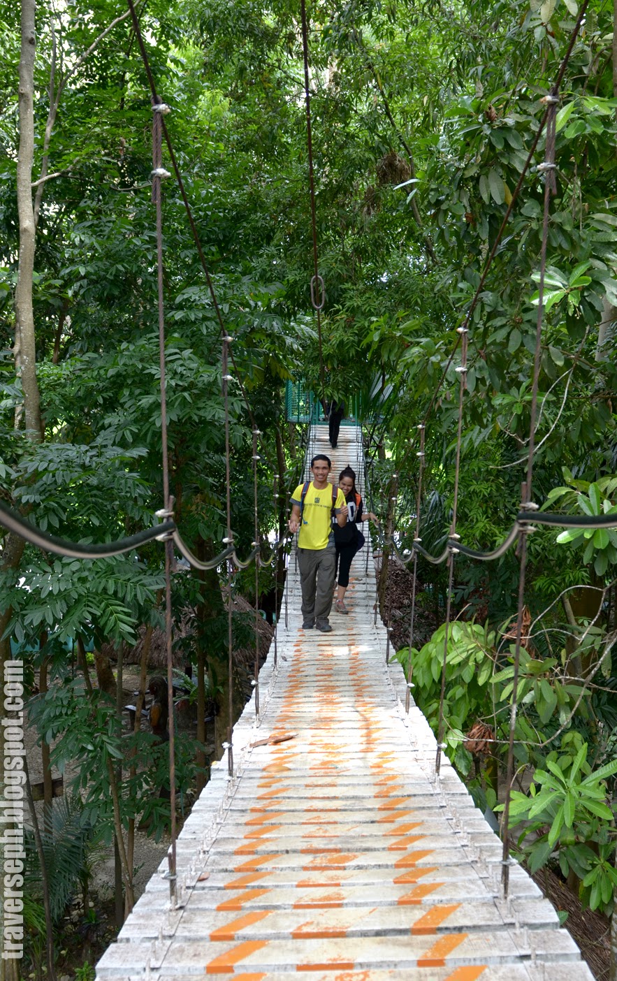
However the trail is covered with small trees, well maintained plains; and plenty of rest stops. Daraitan has rewarding limestone viewpoints and offers a more challenging two to three hours of hiking (Ascent). There are two camping grounds up to the summit (sad to say, no water source yet) for a night stay.
At the summit,there is a mounted flag pole, thus marking the highest point of the mountain. From thence, one may experience the peaceful view of the mountain ranges of Sierra Madre at the East/ North-east side and a wide glimpse of Laguna de Bay as well as the figure of eight Daraitan river right below. Moreover, if keen enough, distant mountains like Makiling, Cristobal, Banahaw, Sembrano and Tagapo are visible on a clear sky.
From the summit, take the trail route leading down the Tinipak River (1-1.5hrs hiking). I suggest you may take a dip. It is such a favorable side trip after climbing Mt. Daraitan. Tinipak river's highlight include the beautiful limestone boulders and the warm fresh natural pool; a popular camping site; and a place and avenue suitable for caving, spelunking, swimming and rock climbing. Almost 90% of hikers take Tinipak river as a last stop after any other to indulge into the warm natural pool of Tinipak.

TRANSPORTATION
EDSA-Shaw Blvd. Take jeepneys bound to Tanay, Rizal (59php), 1.5-2 hrs traveling time.
TANAY Terminal. Take jeepneys directly bound to Brgy. Daraitan or via Sampaloc (26php), 45mins
SAMPALOC to Daraitan. Hire tricycle going to Brgy. Daraitan(Hall); 3 pax/tricycle (300php) 1 hr.

FEES
Environmental fee- 20php/pax
Guide- 500/dayhike (summit-tinipak)
         - 1,200 overnight
           *maximum of 10 pax/guide
Tinipak River Fee- 20 php

  MT. DARAITAN/ TINIPAK PHOTOS


ITINERARY 
I don’t post any detailed itinerary because I believe such should be experienced by nobody else but you, yourself. General time frame in every stops are shown in the transportation and hiking part of the article.

Monday, July 14, 2014

Queen city of the south:Top five historical landmarks | Cebu "Sugbu"

SUGBU| The Queen City of the south. The city is located on the eastern shore of Cebu island. It is the first Spanish settlement and the oldest city in the Philippines. Cebu is the Philippines' main domestic shipping port and is home to about 80% of the country's domestic shipping companies.


HISTORICAL LANDMARKS to visit:

Magellans Cross | Magallanes Street, Cebu City

The Cross was rooted on April 21, 1521 by Ferdinand Magellan. This marks the spot where the first Christian Filipinos, Rajah Humabon and Queen Juana and about 400 followers were baptized by Father Pedro Valderama. In 1525-1740, the Augustinian priests built an open shrine for the cross. However, the locals began to chip off the cross believing it had miraculous power. To salvage what has remained of it, a kiosk-like structure was built as protection. Innovation has been made to the minimum and at present, a hollow cross made of “Tindalo” wood stands to incase the original cross for further protection and preservation.


Fort San Pedro | Plaza Independencia, Cebu City

The fort was named San Pedro, most probably, in honor of Legaspi’s flagship. Fort San Pedro is the smallest and oldest triangular bastion in the country, which was built in 1565 and completed over a century and a half later. The original structure of Fort San Pedro was temporarily built in such a way so as to provide immediate security from the presence of the Spanish expedition encamped within the shores of Zugbu (Cebu). It has also witnessed the different changes, struggles, and wins Cebu had gone through over time although inevitably, much of it was destroyed during the Japanese occupation when it served as a prison camp.


The present fort, a triangular structure of stone and mortar overlooking modern Cebu’s busy port, was rebuilt in 1835 to protect the Spanish settlement from pirates and marauders who used to plunder coastal villages.

Capitol Building | Osmeña Boulevard, Cebu City

It was first built in front of Plaza Independencia , under the realm of the Filipino Revolutionist in 1898 and American Military in 1899. The seat of the Provincial Government is of pre-war vintage and has the undulating mountains of Cebu as its background. Majestic and imposing its high dome, the Capitol was designed by Architect Juan Arellano (1936) and it was relocated geographically along Osmeña Boulevard. Seen as a replica of the United States’ White House, it is one of the many beautiful capitol buildings in the country, constructed in 1937 under the administration of Governor Sotero Cabahug.
“We cannot leave to our posterity the legacy of a life without difficulties and struggles. If we do, we would develop a weak and impotent nation, unfit to survive by its own strength and courage.” -- Sergio Osmeña, Sr.


Lapu-Lapu Monument | Mactan Shrine, Lapu-Lapu City

The monument is dedicated to Lapu-Lapu, the first Filipino hero which stands inside the Mactan Shrine facing Magellan Bay. Lapu-Lapu is considered as the greatest fighter in Philippine history because he was among those who rejected foreign power. He was the chieftain of the area during his time, and defeated Ferdinand Magellan, the leader of the Spanish fleet, in the famous Battle of Mactan.

Taoist Temple | Beverly Hills, Cebu City

Taoist Temple is a concrete reminder of the well-established Chinese Community in Cebu City who has contributed much towards the industrialization of Cebu. The temple was built around 1964 and is a classic example of Chinese architecture which houses the teachings of Lao-Tse (600 B.C. Chinese philosopher). Everyday tourist would climb its 81 "stair steps" (representing the 81 chapters of Taoism scriptures), light joss sticks and have their fortune read. Today, the structure depicts Chinese architecture shared to Philippine culture.


Experience Cebu!

Cebu's famous souvenir shop.


City of Cebu
Dakbayan sa Sugbo
Lungsod ng Cebu
Ciudad de Cebú

Tuesday, July 8, 2014

A travel to Argao "town of famous torta" | Cebu


CABECERA de ARGAO| a town down south of Cebu. It was once a fortified Spanish pueblo or town designed according to the Spanish Crown’s blueprint for its settlement in the colonies. The town center, used to be enclosed by rectangular high walls made of coral stone that has a four main gates located on each side of the perimeter. At present, two entryways still exist. In addition, other main structures that remain of Argao’s wall pueblo of the 1800’s include the San Miguel Archangel Church, Capilla Mortuario, Casa Real and the “paso” or processional courtyard.

Having been to the coastal town, there are beaches everywhere, vast rice fields, as well as varied fishponds in some areas.


Places to visit Argao:
 
Municipal Hall. An ancient looking structure where public business affairs are officially and legally conducted.
Town Plaza. A simple accommodating lawn with white stone benches, with free wifi connectivity as somewhat one of the freebies for visiting their place. You could update your status while sitting on the benches which more often than not, every traveler does. I, for one have done so!

St. Michael’s Church. The square stones that make up the exterior walls still have the traces of the tools that were used to shape the boulders around the building. The bell tower is beautifully preserved, still functional and is yet at its best amidst the test of time. Surely a proof of great filipino artistry and handicraft.

Argao Nature Park. 
An ideal avenue for nature lovers. One may prefer to "chill out" by sitting on the benches, while nibbling on snacks they brought, and merely enjoying the breeze.

However, if you prefer to move around and be active, well,you might want to experience the "short" zip line (with it's height and length safe even for children above 10 years of age at 20php only. It’s a brief trip from the top of the trees to the other side of a man-made lake), or wall-climb and row a boat, all at a budget-friendly cost.


With a meager entrance fee of 5php you can aready explore the park, dine in their kiosk cottages and take a glimpse of some wild life.
Alex Kafe. A simple antique restaurant near the church, it exudes a feeling of an old house with a high ceiling with antiques such as paintings and drawings hanged on the wall. Eye-catching objects such as an old and rusty sewing machine, shelves full of old books and albums from the 80's, a used laver which I believe used to be the trend during the old eras, and many other antiques are on display. When the witty attendant was asked of, she proudly claimed their Halo-halo to be one-of-a-kind, and thus their specialty along with the popular “torta” in town.


How to get there:
Catch up buses bound to Oslob or Dalaguete from the South Bus Terminal. You can choose between a non air conditioned(78php)or airconditioned(86php) bus. Traveling time takes 1.5 hours.

SNAPSHOTS

“Go confidently in the direction of your dreams. Live the life you have imagined.”

Sunday, July 6, 2014

Hiking Talks #17: Day hike to Osmeña Peak | Cebu


MINOR CLIMB| Osmeña peak which is widely located at the Mantalungon mountain range, is unique from other mountain ranges in the Philippines. Why so?..it is because of its unique multiple jagged hills that are wonderfully grouped together. The highest of these hills is the Osmeña Peak itself, named after the reknowned Osmeña clan in Cebu.

At a quick glance, Mantalungon range may seem similar to the Chocolate Hills of Bohol. However, what sets it apart is the fact that the jagged hills of the ranges are much thinner, much edgy or sharp-pointed, and is far more rough.

What's more exhilarating is once you reach the peak, you get to have a 360-degree view of the southwestern coastline of Cebu. You can even see the province of Negros Oriental, and if you are keen enough, even get a sight of Mt. Kanlaon in Negros in a very clear sky.


HIKING
The trek to Osmeña peak is more of relaxing than strenuous. It will only take approximately 20-30 if one would start from the trail head. One could also do a more intense hike starting off from Mantalungon market. This covers a hiking time not less than 2 hours passing through the main road, farm land and community houses.
Per own experience, our trek started at 0930H. A little boy of 8 named,“Alvin” welcomed us with his shy yet warm smile. He offered to guide us up. Even though the trail seemed short and not that complicated, we agreed to let Alvin go with us, since he just ask 50pesos for the guide fee.. and much more, WE fell under his charm. While walking along the trail, we can't help but stop to take a closer look at noticeably wild yellow flowers called“otot-otot” and the multicolored flower said to be named as“ering-ering” (visayan dialect).
The trek may be a bit long but once we have reach the Osmeña Peak, surely, a 360-degree view of the range have captivated our eyes that includes the southwestern coastline of Cebu, and even the province of Negros Oriental. The peak stands approximately 1,013 meters above sea level making it the highest peak in the island of Cebu.
Osmeña Peak and the Mantalungon range are accessible to hikers and mountaineers all-year -round but it is best to climb the peak in the first half of the year since the rainy season tend to fall from June to October. During such time, the peak and mountain ranges more likely become wet and slippery making treking more arduous and risky,for that matter.
Every mountain has a unique experience to give. I highly recommend you trek Osmeña Peak and discover the beauty of the nature. Once you get to the peak, you can definitely exclaim,.."surely,God is the master artist of all"

TRANSPORTATION
One could take the buses traveling southward bound to Oslob or Bato via Dalaguete (Cebu South Bus Terminal) and get off at the Dalaguete junction going up to Mantalungon. Dalaguete is about 85 kilometers from Cebu City and is about 2 hours ride by bus. When you reach Dalaguete, you can take a Habal-habal that will take you up to Mantalungon until into the trailhead (30mins.traveling time).


Thank's to RV and Tom my brother for hiking with me.

TRIVIA
The Utanon Festival, a celebration of dance and music as thanksgiving for the good harvest of Mantalungon. “Utanon” is the Cebuano word for vegetables. Mantalungon is famous as the "Summer Capital of Cebu" because it is 700 to 800 meters above sea level giving it a pleasant climate all year round. The high elevation has made the village an ideal place to grow flowers, vegetables and other high-value crops, which gives Mantalungon the reputation of being the "Vegetable basket of Cebu."


Monday, April 28, 2014

Most hypnotic waterfalls in Biliran ~ Tinago Falls


TINAGO FALLS| is one of the best attractions offered by the province of Biliran. The name "Tinago," means "hidden". At a height of around 90 feet, it is nature's display of beauty.

The most hypnotic waterfalls magnificently lay its beauty in the heart of Caibiran, Biliran. Offers a breathtaking spectacle water and rock formation surrounded by the green vegetation. A hideaway that blends perfectly for nature lovers, rich blend of trees, vines, & other exotic plants accompanied by the cooling & enchanting sounds of rushing streams. The tourists will surely enjoy this paradise that showcases the natural beauty of the province.

Besides being developed as an eco-tourism destination, the falls is also a source of the area's hydroelectric power, a big boon to the people living in the area.


TRANSPORTATION
From Naval, Biliran town proper, reached by any land transportation, approximately 45 minutes to 1 hour. From the highway (jumpoff) one could trek for 15 minutes going to the falls.


LOCATION
Brgy. Cabibihan, Caibiran, Biliran Province

Wednesday, April 23, 2014

Hiking Talks #16: A trek to the most complex volcano in the Philippines ~ Taal Volcano | Crater Lake

 
MINOR CLIMB| Taal Volcano is a part of a chain of volcanoes along the western side of the edge of the island of Luzon. The lake is wholly located in the province of Batangas. The northern half of Volcano Island falls under the jurisdiction of the lake shore town of Talisay, while the southern half belongs to San Nicolas. The other towns that encircle Taal Lake include Talisay,Tanauan, Laurel, Agoncilio, Santa Terisita, Alitatag, Cuenca, Lipa, Balete and Mataas na Kahoy.

With its highest elevation at merely 311 MASL (1,020 ft), Taal is one of the lowest volcanoes in the world. Taal is a complex volcano and it is the second most active volcano in the Philippines with 33 recorded historical eruptions. All of these eruptions are concentrated on Volcano Island-- an island near the middle of Taal Lake. When viewed from Tagaytay Ridge, Taal Volcano and the lake itself represents one of the most marvelous picturesque and attractive views in the Philippines. It is located about 50 km (31 miles) south from the capital city of Manila.

Although the volcano has been quiet since 1977, it has shown signs of unrest since 1991, with strong seismic activity and ground fracturing events, as well as the formation of small mud spots and geysers on certain parts of the island. It brought great changes in the interior of the crater, according to chroniclers of the old. "Before, the bottom looked very deep and seemed unfathomable, but at the bottom, a liquid mass was seen in continual ebullition."

After the eruption, the crater had been found to have widened, the pond within it had been reduced to one-third and the rest of the crater floor was higher and dry enough that they say one may even walk over it. The height of the crater walls has diminished and near the center of the new crater floor, a little hill now lies that continually emits smoke. On its sides were several wells, one of which was especially remarkable for its size.


HIKING 
Crossing the lake is yet the first part of adventure,where one could observe the green-colored (the way I see it) fresh water of Taal Lake. Crossing the Talisay town to the major jump off point in the Volcano Island shoreline takes 15 mins. Since we left late from our destination, we arrived by lunch at the Tourism Office Station where we had our meal in a Canteen nearby.
The trek going to the crater edge will take about 45 minutes to 1 hour at a slow and relaxing pace, trekking a 1.7 KM (Daang Kastila Trail) regular trail. We started our trek at 1300H, not a good time to trek though for we needed to hit the trail under the heat of the sun. 
 
However, as you go up the trail, you will discover that it is an easy, dusty and a wide-open trail--it means that there is not much vegetation that covers the area. One could also opt for horseback riding instead of trekking. However, if you want to burn extra fats in your body, you gotta go for trekking!
 
Like any other hiking destinations in Batangas, the Daang Kastila trail also has a stop over mini stores.The first store is at the middle length of the trail and the next is before the final ascent to the crater edge ‘summit”. More of these stores are at the crater edge where one could refresh and hydrate with cold buko juice, softdrinks, Processed juices and more.
One could also observe to the volcanic quality of the rocks and the sulfuric steam vents along the trail. You would notice it just after the second store stop over. Cooking an egg is possible in this spot for the heat temperature reaches more than the boiling point.

At 1400H, we arrived at the summit. You can imagine the feeling of unwinding by the mere breathtaking view of the Taal Crater Lake. Explore some parts of the crater edge facing the west, take pictures and relax at the nipa huts. The summit offers an excellent viewpoint of the (SE) Mt. Maculot, (SW) Mt. Batulao, (NE) Mt. Makiling, (E) Mt. Malipunyo and nearby Highlands facing the famous Mt. Tabaro (recent site of eruption).
Amazingly there is a small island inside Taal Crater Lake, called the Vulcan point. Thus, everyone could say: It is an island within a lake that is within an island within a lake within an island. Boy aren't you confused! But that's how it is. Sounds amazing doesn't it?
 
After an hour at the summit view point, we descended and headed back to the mainland. Trekking down will take 45 minutes or half of the time going up, depending on your pace.


GREAT-TO-KNOW INFOS
”Bryan Malvataan Boat Station”offers a convenient and reasonable package tour. You may contact the reliable Sir Bryan Malvataan using the following mobile numbers (Smart: 09208490951| Globe: 09173631251/ 09172032792). He will cater to all your needs in the most convenient way. They offer free huts, face masks and even some bottled water. For more information of the breakdown details of package tour you may dial the above mentioned numbers now.
You may coordinate with them before heading to Talisay, so they can assist you and help you manage your entire travel.


TRANSPORTATION
If you are from Manila, take a bus bound to Lipa or Tanauan, Batangas (96 php). Stop at Tanauan bus stop, catch a tricycle that will bring you to the Jeepney Terminal bound to Talisay (10php). Ask the jeepney driver to take you straight to Talisay Town proper. Stop at 7/11 Store (meeting area).

If from Cavite or Tagaytay, simply pick up a tricycle near Rotonda in Tagaytay City. Tell the driver to bring you to Talisay, Brgy. Poblacion 8 via Ligaya Drive (short way). Traveling takes 30-45 minutes, fare for 3 pax is 250 php, and going back to Tagaytay is 300-350 php, considering the ascent of the winding road.

Note: Numerous boat canvassers in Tagaytay have their own hidden additional charges. Be careful. For safe and reasonable travel tours to Taal Volcano contact 'Bryan Malvataan Boat Station'

DETAILS 
Taal Volcano
Batangas Province
Entry point | Talisay, Batangas
311 MASL
Days required/Hours to Summit | Half day/1 hour
Minor Climb| Difficulty 2/9, Trail Class 1/length 1.7 KM
Features: Sulfuric steam/vents | Birds | Volcanic rocks | View of crater lake


Thanks to Janet Babatid and Mcbel Hormigas.

ITINERARY
I don’t post a detailed itinerary because I believe such should be experienced by nobody else but you yourself. General time frame in every stops are shown in the transportation and hiking part of the article.